The debris avalanche deposits
The upper reaches of the North Fork of the Toutle River are filled for about 13 miles, to an average depth of 150 feet, with the remains of debris from three large landslide masses that formed in the intial moments of the 1980 eruption. These masses became fluidized as a result of the pressure from the lateral blast and flowed rapidly downhill, carrying very large blocks of the original mountain (now the hummocks) in a sandy matrix. The image below was taken from the Hummocks Trail off WA 504.
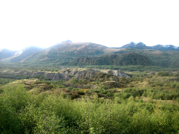
Photo by James Maynard © 2009 - free use with attribution [Full-size, jpeg format]
Map of the debris avalanche from Glicken 1996
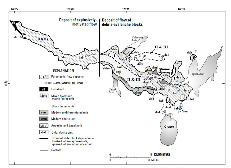
Source: Glicken, H., 1996, Rockslide-debris avalanche of May 18, 1980, Mount St Helens volcano, Washington: U.S. Geological Survey Open-file Report 96-677, 90 pp. [download pdf]